Study Background and Purpose
The City of Las Vegas (City), in cooperation with the Regional Transportation Commission of Southern Nevada (RTC), welcome you to the Northwest Las Vegas Traffic Study website. The purpose of this study is to develop a plan for transportation improvements within the rapidly growing northwest region of the City of Las Vegas to reduce current and future delay for travelers in the area.
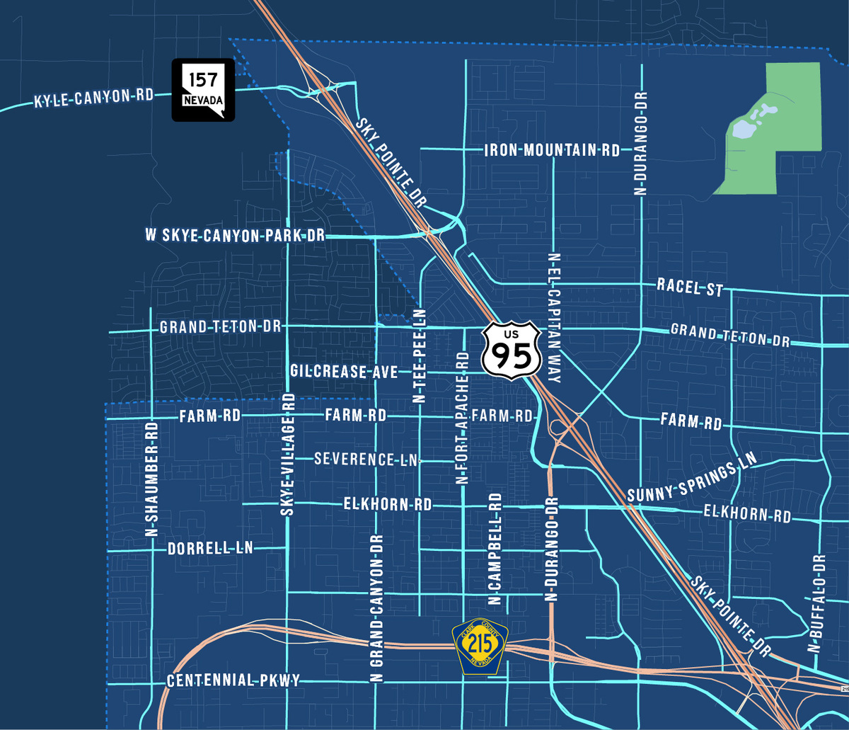
The northwest region of the City of Las Vegas, bounded by Buffalo Drive to the east and Centennial Parkway to the south, has grown at an astounding rate. Over the last 10 years, 22 new traffic signals have been installed with an additional 12 traffic signals added in 2022. Looking forward, traffic volumes in the study area are expected to increase by 44% by the year 2040. A coordinated implementation plan is critical to keep up with this growth and help achieve the City's vision to provide equitable access to services, education, and jobs in the new economy.
View City of Las Vegas Master PlanStudy Goals & Partnership
The study intends to achieve several goals to accomplish the City's vision
To effectively achieve the study goals, the RTC and City of Las Vegas have partnered to deliver the Northwest Las Vegas Traffic Study and engage area stakeholders and residents to ensure a collaborative study process.
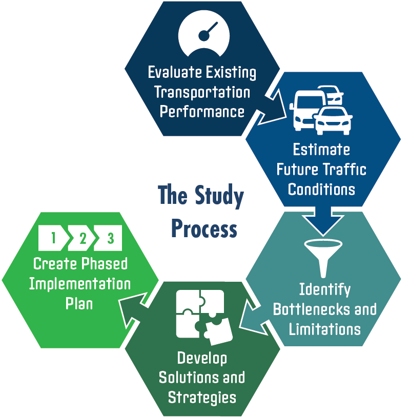
The Study Process
To develop the plan, the study team has evaluated the performance of the existing transportation network, including recently completed projects. From there, future traffic volumes were estimated to determine demand and performance under future 2030 and 2040 conditions. For each timeframe (existing, 2030, and 2040) bottlenecks and system limitations were identified, and solutions developed to address these concerns. This process includes scenarios with and without the planned Sheep Mountain Parkway, which is envisioned to connect the CC 215 with Kyle Canyon. The result is a phased implementation plan to keep the northwest moving for years to come.
The Study Timeline
The graphic below illustrates the anticipated study timeline

Be Heard and Stay Informed
The public comment portion of our study has now concluded. The feedback and comments received have played an essential role in shaping our understanding of the community's needs and priorities.